
Thank you for supporting this site ❤️
Make a donation
Make a donation
An Ses topographic map
Click on the map to display elevation.
Thank you for supporting this site ❤️
Make a donation
Make a donation
About this map
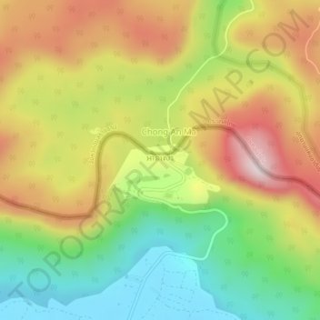
Name: An Ses topographic map, elevation, terrain.
Location: An Ses, Choam Ksant, Preah Vihear, Cambodia (14.36820 104.94460 14.40820 104.98460)
Average elevation: 355 m
Minimum elevation: 97 m
Maximum elevation: 646 m
Thank you for supporting this site ❤️
Make a donation
Make a donation