
Thank you for supporting this site ❤️
Make a donation
Make a donation
Westfield Township topographic map
Click on the map to display elevation.
Thank you for supporting this site ❤️
Make a donation
Make a donation
About this map
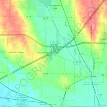
Name: Westfield Township topographic map, elevation, terrain.
Location: Westfield Township, Medina County, Ohio, United States (40.98913 -81.97821 41.06268 -81.87944)
Average elevation: 317 m
Minimum elevation: 287 m
Maximum elevation: 373 m
Thank you for supporting this site ❤️
Make a donation
Make a donation
Other topographic maps
Click on a map to view its topography, its elevation and its terrain.