
Thank you for supporting this site ❤️
Make a donation
Make a donation
Kwaadmechelen topographic map
Click on the map to display elevation.
Thank you for supporting this site ❤️
Make a donation
Make a donation
About this map
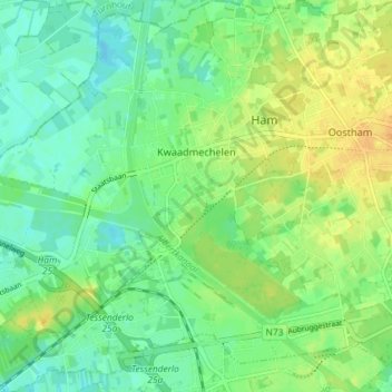
Name: Kwaadmechelen topographic map, elevation, terrain.
Location: Kwaadmechelen, Ham, Hasselt, Limburg, Flanders, 3945, Belgium (51.07370 5.09493 51.11938 5.16754)
Average elevation: 30 m
Minimum elevation: 19 m
Maximum elevation: 44 m
Thank you for supporting this site ❤️
Make a donation
Make a donation