
Gunung Wilis topographic map
Interactive map
Click on the map to display elevation.
About this map
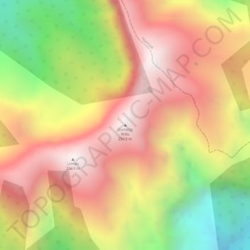
Name: Gunung Wilis topographic map, elevation, terrain.
Location: Gunung Wilis, Kediri, Ost-Java, Indonesien (-7.82064 111.75711 -7.82054 111.75721)
Average elevation: 2,147 m
Minimum elevation: 1,583 m
Maximum elevation: 2,530 m
Other topographic maps
Click on a map to view its topography, its elevation and its terrain.