
Atlanta topographic map
Interactive map
Click on the map to display elevation.
About this map
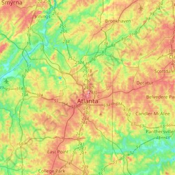
Name: Atlanta topographic map, elevation, terrain.
Average elevation: 284 m
Minimum elevation: 225 m
Maximum elevation: 358 m
Other topographic maps
Click on a map to view its topography, its elevation and its terrain.
Fort McPherson
Vereinigte Staaten von Amerika > Georgia > Fulton County > Atlanta
Fort McPherson, Atlanta, Fulton County, Georgia, 30330, Vereinigte Staaten von Amerika
Average elevation: 309 m