Whitehorse Bluff topographic map
Interactive map
Click on the map to display elevation.
About this map
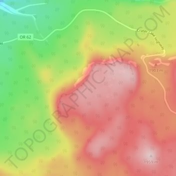
Name: Whitehorse Bluff topographic map, elevation, terrain.
Average elevation: 1,837 m
Minimum elevation: 1,665 m
Maximum elevation: 1,961 m

Click on the map to display elevation.
Name: Whitehorse Bluff topographic map, elevation, terrain.
Average elevation: 1,837 m
Minimum elevation: 1,665 m
Maximum elevation: 1,961 m