
Thank you for supporting this site ❤️
Make a donation
Make a donation
Marufinas topographic map
Click on the map to display elevation.
Thank you for supporting this site ❤️
Make a donation
Make a donation
About this map
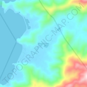
Name: Marufinas topographic map, elevation, terrain.
Location: Marufinas, Puerto Princesa, Mimaropa, Philippines (10.22423 118.94056 10.26423 118.98056)
Average elevation: 84 m
Minimum elevation: -1 m
Maximum elevation: 429 m
Thank you for supporting this site ❤️
Make a donation
Make a donation
Other topographic maps
Click on a map to view its topography, its elevation and its terrain.