
Austin topographic map
Click on the map to display elevation.
About this map
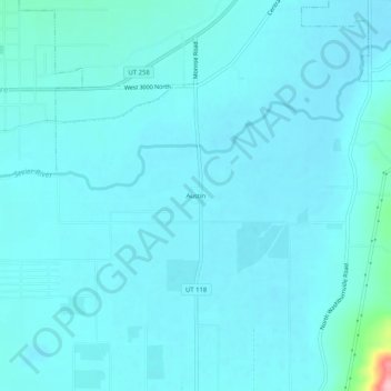
Name: Austin topographic map, elevation, terrain.
Location: Austin, Sevier County, Utah, 84724, United States (38.65219 -112.14159 38.69219 -112.10159)
Average elevation: 1,624 m
Minimum elevation: 1,610 m
Maximum elevation: 1,772 m
Other topographic maps
Click on a map to view its topography, its elevation and its terrain.
Richfield
United States > Utah > Sevier County
Richfield experiences a cold semi-arid climate (Köppen BSk) with four distinct seasons. Winter high temperatures average in the 30s and 40s with many milder days; low temperatures average in the teens and twenties, with a few mornings starting near or below zero. Snowfall is common, but usually melts in a day…
Average elevation: 1,659 m
Fish Lake
United States > Utah > Sevier County
Fish Lake is a high alpine lake (elevation approximately 8,848 ft or 2,700 m) located in the Fishlake/ Southern Wasatch Plateau region of south-central Utah, United States. It lies within and is the namesake of the Fishlake National Forest.
Average elevation: 2,886 m
Richfield
United States > Utah > Sevier County
Richfield experiences a cold semi-arid climate (Köppen BSk) with four distinct seasons. Winter high temperatures average in the 30s and 40s with many milder days; low temperatures average in the teens and twenties, with a few mornings starting near or below zero. Snowfall is common, but usually melts in a day…
Average elevation: 1,659 m