
Elspe topographic map
Interactive map
Click on the map to display elevation.
About this map
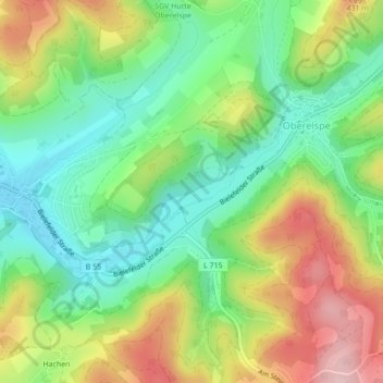
Name: Elspe topographic map, elevation, terrain.
Average elevation: 356 m
Minimum elevation: 269 m
Maximum elevation: 484 m
Other topographic maps
Click on a map to view its topography, its elevation and its terrain.
Kracht
Deutschland > Nordrhein-Westfalen > Lennestadt > Kracht
Kracht, Lennestadt, Kreis Olpe, Nordrhein-Westfalen, 57368, Deutschland
Average elevation: 366 m
Milchenbach
Deutschland > Nordrhein-Westfalen > Lennestadt
Milchenbach, Lennestadt, Kreis Olpe, Regierungsbezirk Arnsberg, Nordrhein-Westfalen, Deutschland
Average elevation: 595 m
Hohe Bracht
Deutschland > Nordrhein-Westfalen > Lennestadt
Hohe Bracht, Lennestadt, Kreis Olpe, Nordrhein-Westfalen, 57368, Deutschland
Average elevation: 444 m