
Thank you for supporting this site ❤️
Make a donation
Make a donation
Juata Laut topographic map
Click on the map to display elevation.
Thank you for supporting this site ❤️
Make a donation
Make a donation
About this map
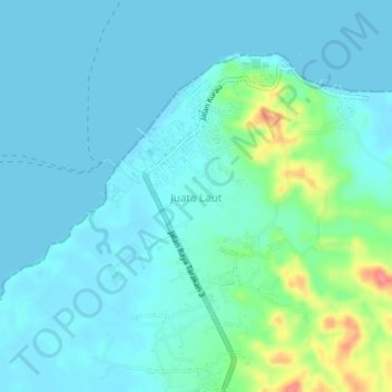
Name: Juata Laut topographic map, elevation, terrain.
Location: Juata Laut, Tarakan, North Kalimantan, Kalimantan, Indonesia (3.40790 117.52535 3.44790 117.56535)
Average elevation: 14 m
Minimum elevation: -1 m
Maximum elevation: 83 m
Thank you for supporting this site ❤️
Make a donation
Make a donation
Other topographic maps
Click on a map to view its topography, its elevation and its terrain.