
River Ridge topographic map
Interactive map
Click on the map to display elevation.
About this map
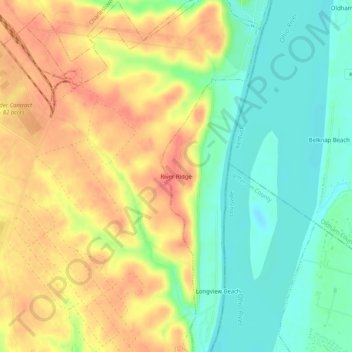
Name: River Ridge topographic map, elevation, terrain.
Location: River Ridge, Clark County, Indiana, United States of America (38.35868 -85.66552 38.39868 -85.62552)
Average elevation: 157 m
Minimum elevation: 126 m
Maximum elevation: 188 m