
Thank you for supporting this site ❤️
Make a donation
Make a donation
Mishar topographic map
Click on the map to display elevation.
Thank you for supporting this site ❤️
Make a donation
Make a donation
About this map
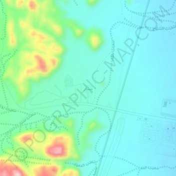
Name: Mishar topographic map, elevation, terrain.
Location: Mishar, Hail, Ḥa'il Province, 55471, Saudi Arabia (27.55974 41.62692 27.59974 41.66692)
Average elevation: 1,062 m
Minimum elevation: 1,003 m
Maximum elevation: 1,272 m
Thank you for supporting this site ❤️
Make a donation
Make a donation
Other topographic maps
Click on a map to view its topography, its elevation and its terrain.