
Horní Bečva topographic map
Interactive map
Click on the map to display elevation.
About this map
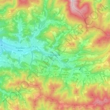
Name: Horní Bečva topographic map, elevation, terrain.
Average elevation: 676 m
Minimum elevation: 436 m
Maximum elevation: 1,012 m
Other topographic maps
Click on a map to view its topography, its elevation and its terrain.
Ungarisch Ostra
Tschechien > Mittelmähren > Region Zlin
Ungarisch Ostra, Bezirk Ungarisch Hradisch, Region Zlin, Mittelmähren, Tschechien
Average elevation: 181 m
Otrokowitz
Tschechien > Mittelmähren > Region Zlin > Otrokowitz
Otrokowitz, Bezirk Zlin, Region Zlin, Mittelmähren, 765 02, Tschechien
Average elevation: 207 m
Zlin
Tschechien > Mittelmähren > Region Zlin
Zlin, Bezirk Zlin, Region Zlin, Mittelmähren, Tschechien
Average elevation: 312 m