
Villatella topographic map
Interactive map
Click on the map to display elevation.
About this map
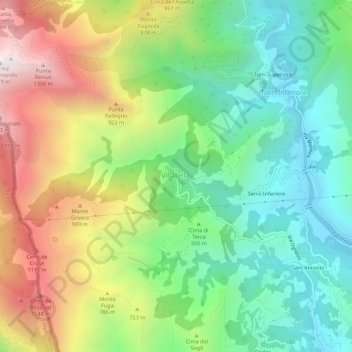
Name: Villatella topographic map, elevation, terrain.
Location: Villatella, Ventimiglia, Imperia, Ligurien, 18030, Italien (43.80883 7.51586 43.84883 7.55586)
Average elevation: 544 m
Minimum elevation: 39 m
Maximum elevation: 1,365 m
Other topographic maps
Click on a map to view its topography, its elevation and its terrain.
Torri Superiore
Italien > Ligurien > Imperia > Ventimiglia > Torri Inferiore
Torri Superiore, Torri Inferiore, Ventimiglia, Imperia, Ligurien, 18030, Italien
Average elevation: 343 m