
Thank you for supporting this site ❤️
Make a donation
Make a donation
Asientos topographic map
Click on the map to display elevation.
Thank you for supporting this site ❤️
Make a donation
Make a donation
Asientos
The municipality of Asientos is located in the north-east of the state and has a territorial area of 547.74 kilometres squared which is equivalent to 9.84% of the total area of the state and it has an altitude ranging from 1800 to 2700 metres above sea level.
Thank you for supporting this site ❤️
Make a donation
Make a donation
About this map
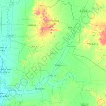
Name: Asientos topographic map, elevation, terrain.
Location: Asientos, Aguascalientes, Mexico (21.95839 -102.21933 22.30607 -101.85416)
Average elevation: 2,042 m
Minimum elevation: 1,871 m
Maximum elevation: 2,633 m
Thank you for supporting this site ❤️
Make a donation
Make a donation
Other topographic maps
Click on a map to view its topography, its elevation and its terrain.