
Thank you for supporting this site ❤️
Make a donation
Make a donation
Grandview Estates topographic map
Click on the map to display elevation.
Thank you for supporting this site ❤️
Make a donation
Make a donation
About this map
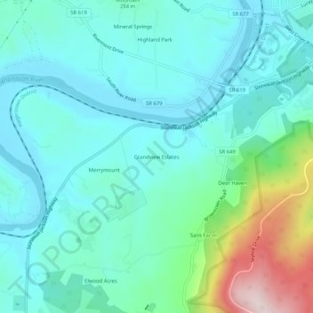
Name: Grandview Estates topographic map, elevation, terrain.
Location: Grandview Estates, Warren County, Virginia, United States (38.87511 -78.24528 38.91511 -78.20528)
Average elevation: 232 m
Minimum elevation: 140 m
Maximum elevation: 591 m
Thank you for supporting this site ❤️
Make a donation
Make a donation