
Nothum topographic map
Interactive map
Click on the map to display elevation.
About this map
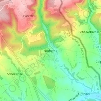
Name: Nothum topographic map, elevation, terrain.
Location: Nothum, Attert, Arel, Luxemburg, Wallonien, 6717, Belgien (49.75175 5.76614 49.79175 5.80614)
Average elevation: 365 m
Minimum elevation: 282 m
Maximum elevation: 481 m
Other topographic maps
Click on a map to view its topography, its elevation and its terrain.