
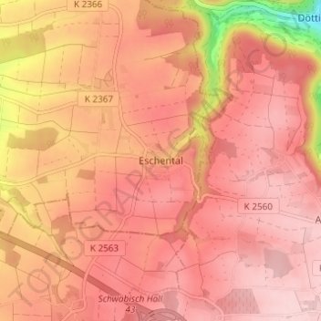
Eschental topographic map
Interactive map
Click on the map to display elevation.
About this map
Name: Eschental topographic map, elevation, terrain.
Average elevation: 394 m
Minimum elevation: 244 m
Maximum elevation: 449 m
Other topographic maps
Click on a map to view its topography, its elevation and its terrain.
Öhringen
Duitsland > Baden-Württemberg > Hohenlohekreis
Öhringen, Verwaltungsgemeinschaft Öhringen, Hohenlohekreis, Baden-Württemberg, 74613, Duitsland
Average elevation: 282 m
Rossach
Duitsland > Baden-Württemberg > Hohenlohekreis > Schöntal > Rossach
Rossach, Schöntal, Hohenlohekreis, Baden-Württemberg, 74241, Duitsland
Average elevation: 304 m