
Thank you for supporting this site ❤️
Make a donation
Make a donation
Herring Cove topographic map
Click on the map to display elevation.
Thank you for supporting this site ❤️
Make a donation
Make a donation
About this map
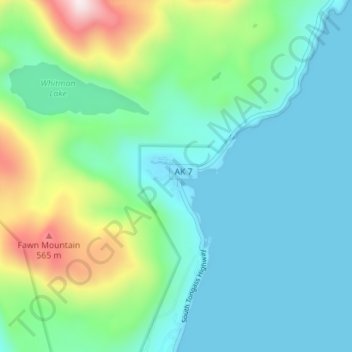
Name: Herring Cove topographic map, elevation, terrain.
Location: Herring Cove, Ketchikan Gateway, Alaska, United States (55.30601 -131.54647 55.34601 -131.50647)
Average elevation: 157 m
Minimum elevation: -2 m
Maximum elevation: 695 m
Thank you for supporting this site ❤️
Make a donation
Make a donation
Other topographic maps
Click on a map to view its topography, its elevation and its terrain.