
Thank you for supporting this site ❤️
Make a donation
Make a donation
Suktia topographic map
Click on the map to display elevation.
Thank you for supporting this site ❤️
Make a donation
Make a donation
About this map
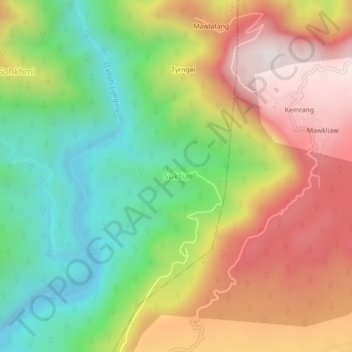
Name: Suktia topographic map, elevation, terrain.
Location: Suktia, Shella Bholaganj, East Khasi Hills, Meghalaya, India (25.20446 91.77757 25.24446 91.81757)
Average elevation: 486 m
Minimum elevation: 36 m
Maximum elevation: 1,015 m
Thank you for supporting this site ❤️
Make a donation
Make a donation
Other topographic maps
Click on a map to view its topography, its elevation and its terrain.