
Thank you for supporting this site ❤️
Make a donation
Make a donation
Kälberbronn topographic map
Click on the map to display elevation.
Thank you for supporting this site ❤️
Make a donation
Make a donation
About this map
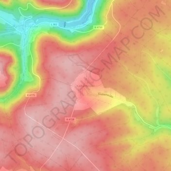
Name: Kälberbronn topographic map, elevation, terrain.
Average elevation: 687 m
Minimum elevation: 544 m
Maximum elevation: 754 m
Thank you for supporting this site ❤️
Make a donation
Make a donation
Other topographic maps
Click on a map to view its topography, its elevation and its terrain.
Waldach
Deutschland > Baden-Württemberg > Landkreis Freudenstadt > Pfalzgrafenweiler
Die Waldach durchläuft dann in sich schlängelndem Tal das Dorf Lützenhardt, den Weiler Vesperweiler, das Dorf Cresbach und die Weiler Ober- und Unterwaldach der Gemeinde, hier nun schon auf Nordostkurs in einem gegen die bewaldeten und mit Rodungsinseln durchsetzten Randhöhen rund 80 Meter eingetieften…
Average elevation: 575 m