
Make a donation
White Haven topographic map
Click on the map to display elevation.
Make a donation
White Haven
White Haven is located at 41°3′34″N 75°46′34″W / 41.05944°N 75.77611°W / 41.05944; -75.77611 (41.059532, -75.776123). The borough is 17 miles (27 km) south of Wilkes-Barre, and 4 miles (6 km) west of the I-476 and I-80 interchange. According to the U.S. Census Bureau, the borough has a total area of 1.2 square miles (3.2 km2), of which 1.2 square miles (3.2 km2) is land and 0.04 square miles (0.1 km2), or 2.12%, is water. White Haven's elevation is 1,221 feet (372 m) above sea level.
Make a donation
About this map
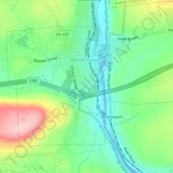
Name: White Haven topographic map, elevation, terrain.
Location: White Haven, Luzerne County, Pennsylvania, United States (41.04716 -75.79072 41.06562 -75.76989)
Average elevation: 391 m
Minimum elevation: 324 m
Maximum elevation: 519 m
Make a donation
Other topographic maps
Click on a map to view its topography, its elevation and its terrain.
Roaring Brook
United States > Pennsylvania > Luzerne County > Hunlock Township
Average elevation: 337 m
Make a donation
Make a donation
Town Hill
United States > Pennsylvania > Luzerne County > Huntington Township
Average elevation: 281 m
Make a donation
Glen Summit
United States > Pennsylvania > Luzerne County > Fairview Township
Average elevation: 539 m
Make a donation
Liewellyn Corners
United States > Pennsylvania > Luzerne County > Bear Creek Township
Average elevation: 449 m
Wapwallopen
United States > Pennsylvania > Luzerne County > Conyngham Township
Average elevation: 223 m
Wapwallopen
United States > Pennsylvania > Luzerne County > Conyngham Township
Average elevation: 223 m
Make a donation
Make a donation
Huntington Mills
United States > Pennsylvania > Luzerne County > Huntington Township
Average elevation: 289 m
Make a donation
Hunlock Creek
United States > Pennsylvania > Luzerne County > Hunlock Township > Hunlock
Average elevation: 276 m
Fern Glen
United States > Pennsylvania > Luzerne County > Black Creek Township
Average elevation: 391 m
Make a donation
Ricketts Glen State Park
United States > Pennsylvania > Luzerne County > Fairmount Township
The state's original plans for the new park included building an inn, an 18-hole golf course and country club, and a winter sports complex for skiing, ice boating, and tobogganing, as well as a beach with bathing facilities, cabins, and a tent camping area. Only the last three were actually built, all south of…
Average elevation: 588 m
South Pond Dam
United States > Pennsylvania > Luzerne County > Hanover Township
Average elevation: 204 m
Make a donation
Fern Glen
United States > Pennsylvania > Luzerne County > Black Creek Township
Average elevation: 391 m
Make a donation