
Stans topographic map
Interactive map
Click on the map to display elevation.
About this map
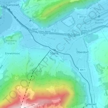
Name: Stans topographic map, elevation, terrain.
Location: Stans, Nidwalden, Zwitserland (46.93129 8.34166 46.98193 8.38875)
Average elevation: 658 m
Minimum elevation: 432 m
Maximum elevation: 1,779 m
De gemeente heeft 7353 inwoners (dec. 2003), ligt op 452 meter hoogte en beslaat 1108 hectare (11.08 km²).
Other topographic maps
Click on a map to view its topography, its elevation and its terrain.
Emmetten
Zwitserland > Nidwalden > Emmetten
Emmetten, Nidwalden, 6376, Zwitserland
Average elevation: 1,009 m