
Thank you for supporting this site ❤️
Make a donation
Make a donation
Pian Meyer topographic map
Click on the map to display elevation.
Thank you for supporting this site ❤️
Make a donation
Make a donation
About this map
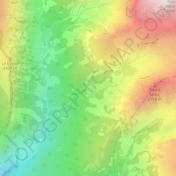
Name: Pian Meyer topographic map, elevation, terrain.
Location: Pian Meyer, Pontechianale, Cuneo, Piedmont, Italy (44.61909 7.06157 44.63909 7.08157)
Average elevation: 2,231 m
Minimum elevation: 1,602 m
Maximum elevation: 3,035 m
Thank you for supporting this site ❤️
Make a donation
Make a donation