
Sirai topographic map
Click on the map to display elevation.
About this map
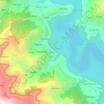
Name: Sirai topographic map, elevation, terrain.
Location: Sirai, Tehri, Tehri Garhwal, Uttarakhand, 249145, India (30.41074 78.40817 30.45074 78.44817)
Average elevation: 1,021 m
Minimum elevation: 644 m
Maximum elevation: 1,851 m