
Pisuquía topographic map
Click on the map to display elevation.
About this map
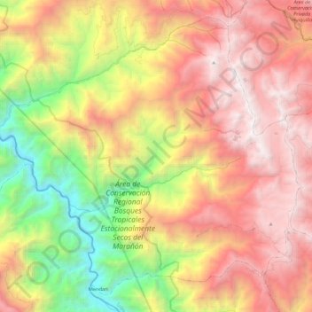
Name: Pisuquía topographic map, elevation, terrain.
Location: Pisuquía, Provincia de Luya, Amazonas, Perú (-6.56547 -78.20625 -6.37498 -77.99096)
Average elevation: 2,358 m
Minimum elevation: 681 m
Maximum elevation: 3,890 m
Other topographic maps
Click on a map to view its topography, its elevation and its terrain.