
Thank you for supporting this site ❤️
Make a donation
Make a donation
Fiumenero topographic map
Click on the map to display elevation.
Thank you for supporting this site ❤️
Make a donation
Make a donation
About this map
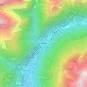
Name: Fiumenero topographic map, elevation, terrain.
Location: Fiumenero, Valbondione, Bergamo, Lombardia, 24020, Italia (46.00116 9.93725 46.04116 9.97725)
Average elevation: 1,316 m
Minimum elevation: 719 m
Maximum elevation: 2,318 m
Thank you for supporting this site ❤️
Make a donation
Make a donation
Other topographic maps
Click on a map to view its topography, its elevation and its terrain.