
Thank you for supporting this site ❤️
Make a donation
Make a donation
San Cristoforo topographic map
Click on the map to display elevation.
Thank you for supporting this site ❤️
Make a donation
Make a donation
About this map
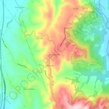
Name: San Cristoforo topographic map, elevation, terrain.
Location: San Cristoforo, Ficulle, Terni, Umbria, 05016, Italia (42.82723 12.04765 42.86723 12.08765)
Average elevation: 345 m
Minimum elevation: 210 m
Maximum elevation: 550 m
Thank you for supporting this site ❤️
Make a donation
Make a donation