
Tourtour topographic map
Interactive map
Click on the map to display elevation.
Tourtour
Tourtour ist eine südfranzösische Gemeinde im Département Var in der Region Provence-Alpes-Côte d’Azur. Sie liegt auf einer Höhe von 635 m, 25 km nordwestlich von Draguignan und hat 583 Einwohner (Stand 1. Januar 2018). Sie gehört zum Kanton Flayosc im Arrondissement Brignoles. Von der Vereinigung Les Plus Beaux Villages de France wurde Tourtour in die Liste der schönsten Dörfer Frankreichs aufgenommen.
About this map
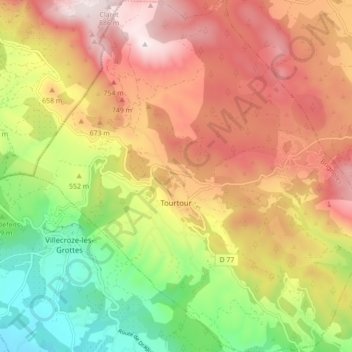
Name: Tourtour topographic map, elevation, terrain.
Average elevation: 582 m
Minimum elevation: 240 m
Maximum elevation: 898 m