
Pass Island topographic map
Click on the map to display elevation.
About this map
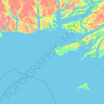
Name: Pass Island topographic map, elevation, terrain.
Location: Pass Island, Newfoundland, Newfoundland and Labrador, Canada (47.16963 -56.51761 47.80963 -55.87761)
Average elevation: 56 m
Minimum elevation: -1 m
Maximum elevation: 462 m
Other topographic maps
Click on a map to view its topography, its elevation and its terrain.