
Make a donation
Lake San Cristobal topographic map
Click on the map to display elevation.
Make a donation
Lake San Cristobal
Lake San Cristobal is a lake in the U.S. state of Colorado. Located in the San Juan Mountains at an elevation of 9,003 feet (2,744 m), the freshwater lake is 2.1 miles (3.4 km) long, up to 89 feet (27 m) deep, has a surface area of 0.52 square miles (1.3 km2), and holds about 11,000 acre-feet (14,000,000 m3) of water. The town of Lake City, a few miles to the north, is named after Lake San Cristobal. The name San Cristóbal means Saint Christopher in the Spanish language. Many old silver mines are near the lake and it is very clean and well kept, and stocked with Rainbow Trout.
Make a donation
About this map
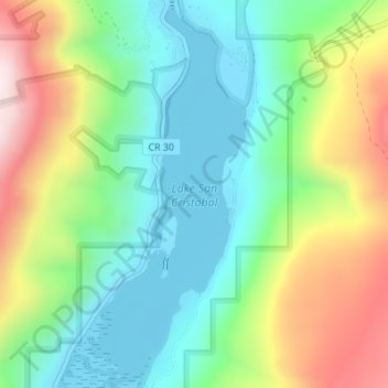
Name: Lake San Cristobal topographic map, elevation, terrain.
Average elevation: 2,947 m
Minimum elevation: 2,744 m
Maximum elevation: 3,326 m
Make a donation
Other topographic maps
Click on a map to view its topography, its elevation and its terrain.