
Thank you for supporting this site ❤️
Make a donation
Make a donation
Centre Wellington topographic map
Click on the map to display elevation.
Thank you for supporting this site ❤️
Make a donation
Make a donation
About this map
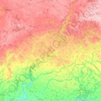
Name: Centre Wellington topographic map, elevation, terrain.
Location: Centre Wellington, Wellington County, Ontario, Canada (43.58306 -80.55751 43.85774 -80.22289)
Average elevation: 419 m
Minimum elevation: 320 m
Maximum elevation: 504 m
Thank you for supporting this site ❤️
Make a donation
Make a donation
Other topographic maps
Click on a map to view its topography, its elevation and its terrain.