
Thank you for supporting this site ❤️
Make a donation
Make a donation
La Reid topographic map
Click on the map to display elevation.
Thank you for supporting this site ❤️
Make a donation
Make a donation
About this map
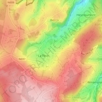
Name: La Reid topographic map, elevation, terrain.
Location: La Reid, Theux, Verviers, Liège, Wallonie, 4910, Belgique (50.46761 5.76580 50.50761 5.80580)
Average elevation: 338 m
Minimum elevation: 218 m
Maximum elevation: 414 m
Thank you for supporting this site ❤️
Make a donation
Make a donation