
Thank you for supporting this site ❤️
Make a donation
Make a donation
Val Thorens topographic map
Click on the map to display elevation.
Thank you for supporting this site ❤️
Make a donation
Make a donation
Val Thorens
Val Thorens ([val tɔʁɑ̃]) is a ski town in the Tarentaise Valley in the French Alps at an altitude of 2,300 m (7,500 ft). It is located in the commune of Saint-Martin-de-Belleville in the Savoie department. The resort forms part of the Les Trois Vallées ski area which, with over 600 km of slopes, is one of the largest linked ski areas in the world.
Thank you for supporting this site ❤️
Make a donation
Make a donation
About this map
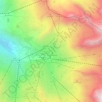
Name: Val Thorens topographic map, elevation, terrain.
Average elevation: 2,516 m
Minimum elevation: 1,914 m
Maximum elevation: 3,145 m
Thank you for supporting this site ❤️
Make a donation
Make a donation
Other topographic maps
Click on a map to view its topography, its elevation and its terrain.