
Thank you for supporting this site ❤️
Make a donation
Make a donation
Taboada topographic map
Click on the map to display elevation.
Thank you for supporting this site ❤️
Make a donation
Make a donation
About this map
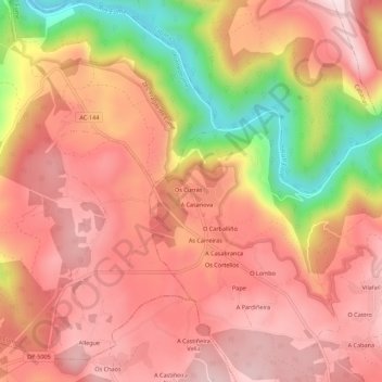
Name: Taboada topographic map, elevation, terrain.
Location: Taboada, Monfero, Eume, La Coruña, Galicia, 15315, España (43.38564 -8.12426 43.42564 -8.08426)
Average elevation: 286 m
Minimum elevation: 2 m
Maximum elevation: 433 m
Thank you for supporting this site ❤️
Make a donation
Make a donation
Other topographic maps
Click on a map to view its topography, its elevation and its terrain.