
Thank you for supporting this site ❤️
Make a donation
Make a donation
Khatanga topographic map
Click on the map to display elevation.
Thank you for supporting this site ❤️
Make a donation
Make a donation
Khatanga
Khatanga (Russian: Ха́танга) is a rural locality (a selo) in Taymyrsky Dolgano-Nenetsky District of Krasnoyarsk Krai, Russia, located on the Khatanga River on the Taymyr Peninsula. It is one of the northernmost inhabited localities in Russia. Its elevation is 30 metres (98 ft) above sea level. As of the 2002 Census, its population was 3,450.
Thank you for supporting this site ❤️
Make a donation
Make a donation
About this map
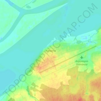
Name: Khatanga topographic map, elevation, terrain.
Average elevation: 11 m
Minimum elevation: -4 m
Maximum elevation: 38 m
Thank you for supporting this site ❤️
Make a donation
Make a donation