
Pawa topographic map
Interactive map
Click on the map to display elevation.
About this map
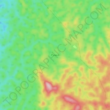
Name: Pawa topographic map, elevation, terrain.
Location: Pawa, Mambasa, Ituri, Democratic Republic of the Congo (2.07674 29.59326 2.15674 29.67326)
Average elevation: 1,145 m
Minimum elevation: 1,045 m
Maximum elevation: 1,311 m