
Thank you for supporting this site ❤️
Make a donation
Make a donation
Pittsburgh Hill topographic map
Click on the map to display elevation.
Thank you for supporting this site ❤️
Make a donation
Make a donation
About this map
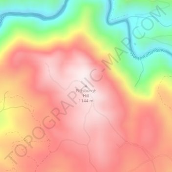
Name: Pittsburgh Hill topographic map, elevation, terrain.
Location: Pittsburgh Hill, Yuba County, California, United States (39.51512 -121.10028 39.51522 -121.10018)
Average elevation: 920 m
Minimum elevation: 582 m
Maximum elevation: 1,149 m
Thank you for supporting this site ❤️
Make a donation
Make a donation
Other topographic maps
Click on a map to view its topography, its elevation and its terrain.