
Make a donation
Nayarit topographic map
Click on the map to display elevation.
Make a donation
Nayarit
Nayarit's natural vegetation varies with altitude; coastal lowlands and river valleys were, historically, covered with tropical dry forest, containing many native deciduous trees that lost their leaves during the dry seasons. The Sinaloan dry forests now cover the northern coastal lowlands, and extend up the valleys of the San Pedro Mezquital River and the Río Grande de Santiago and its tributaries. The Jalisco dry forests ecoregion covers coastal Nayarit south of San Blas and the Islas Marías.
Make a donation
About this map
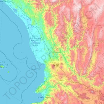
Name: Nayarit topographic map, elevation, terrain.
Location: Nayarit, Mexico (20.60322 -106.70322 23.08450 -103.72090)
Average elevation: 834 m
Minimum elevation: -2 m
Maximum elevation: 3,202 m
Make a donation
Other topographic maps
Click on a map to view its topography, its elevation and its terrain.