
Hergenrath topographic map
Interactive map
Click on the map to display elevation.
About this map
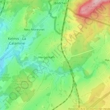
Name: Hergenrath topographic map, elevation, terrain.
Location: Hergenrath, Kelmis, Verviers, Lüttich, Wallonien, 4728, Belgien (50.69153 5.99347 50.72843 6.06157)
Average elevation: 243 m
Minimum elevation: 174 m
Maximum elevation: 366 m