
Laret topographic map
Interactive map
Click on the map to display elevation.
About this map
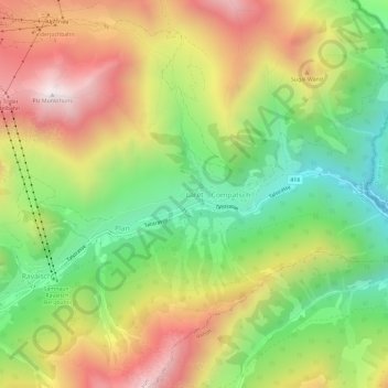
Name: Laret topographic map, elevation, terrain.
Average elevation: 2,023 m
Minimum elevation: 1,498 m
Maximum elevation: 2,637 m
Other topographic maps
Click on a map to view its topography, its elevation and its terrain.
Samnaun
Zwitserland > Graubünden > Region Engiadina Bassa/Val Müstair
Samnaun, Region Engiadina Bassa/Val Müstair, Graubünden, Zwitserland
Average elevation: 2,369 m
Tschierv
Zwitserland > Graubünden > Region Engiadina Bassa/Val Müstair > Val Müstair > Tschierv
Tschierv, Val Müstair, Region Engiadina Bassa/Val Müstair, Graubünden, 7532, Zwitserland
Average elevation: 2,023 m