
Thank you for supporting this site ❤️
Make a donation
Make a donation
Juárez topographic map
Click on the map to display elevation.
Thank you for supporting this site ❤️
Make a donation
Make a donation
About this map
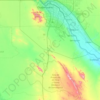
Name: Juárez topographic map, elevation, terrain.
Location: Juárez, Chihuahua, Mexico (31.11996 -106.95163 31.78392 -106.18088)
Average elevation: 1,249 m
Minimum elevation: 1,085 m
Maximum elevation: 1,795 m
Thank you for supporting this site ❤️
Make a donation
Make a donation