
Tielen topographic map
Interactive map
Click on the map to display elevation.
About this map
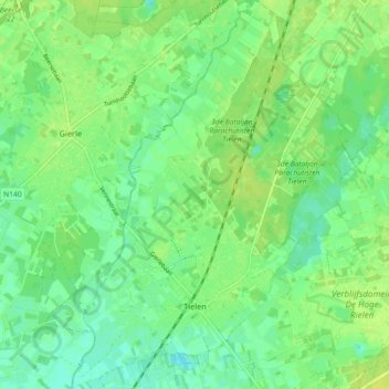
Name: Tielen topographic map, elevation, terrain.
Location: Tielen, Kasterlee, Turnhout, Antwerpen, Vlaanderen, België (51.23028 4.86178 51.28690 4.93391)
Average elevation: 16 m
Minimum elevation: 8 m
Maximum elevation: 24 m
Other topographic maps
Click on a map to view its topography, its elevation and its terrain.
Heuvelrug tussen Lichtaart en Kasterlee
België > Antwerpen > Turnhout > Kasterlee
Heuvelrug tussen Lichtaart en Kasterlee, Kasterlee, Turnhout, Antwerpen, Vlaanderen, België
Average elevation: 17 m