
Thank you for supporting this site ❤️
Make a donation
Make a donation
Caramanico Terme topographic map
Click on the map to display elevation.
Thank you for supporting this site ❤️
Make a donation
Make a donation
About this map
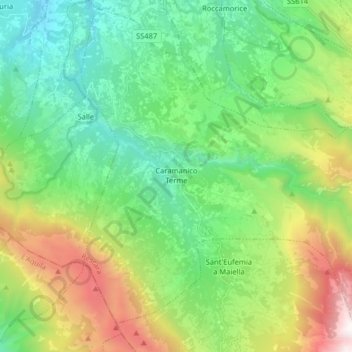
Name: Caramanico Terme topographic map, elevation, terrain.
Location: Caramanico Terme, Pescara, 65023, Italy (42.09965 13.95884 42.21347 14.11947)
Average elevation: 957 m
Minimum elevation: 212 m
Maximum elevation: 2,654 m
Thank you for supporting this site ❤️
Make a donation
Make a donation
Other topographic maps
Click on a map to view its topography, its elevation and its terrain.