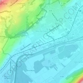
Gilly-sur-Isère topographic map
Interactive map
Click on the map to display elevation.
About this map
Name: Gilly-sur-Isère topographic map, elevation, terrain.
Average elevation: 364 m
Minimum elevation: 310 m
Maximum elevation: 633 m

Click on the map to display elevation.
Name: Gilly-sur-Isère topographic map, elevation, terrain.
Average elevation: 364 m
Minimum elevation: 310 m
Maximum elevation: 633 m