
Thank you for supporting this site ❤️
Make a donation
Make a donation
Westgate-on-Sea topographic map
Click on the map to display elevation.
Thank you for supporting this site ❤️
Make a donation
Make a donation
About this map
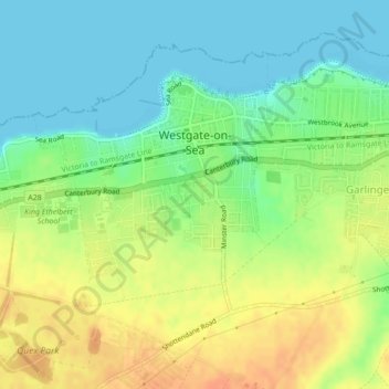
Name: Westgate-on-Sea topographic map, elevation, terrain.
Location: Westgate-on-Sea, Thanet, Kent, England, United Kingdom (51.36748 1.31926 51.38839 1.34531)
Average elevation: 17 m
Minimum elevation: 0 m
Maximum elevation: 38 m
Thank you for supporting this site ❤️
Make a donation
Make a donation
Other topographic maps
Click on a map to view its topography, its elevation and its terrain.
Thank you for supporting this site ❤️
Make a donation
Make a donation
Thank you for supporting this site ❤️
Make a donation
Make a donation
Thank you for supporting this site ❤️
Make a donation
Make a donation