
Thank you for supporting this site ❤️
Make a donation
Make a donation
Doe Lake topographic map
Click on the map to display elevation.
Thank you for supporting this site ❤️
Make a donation
Make a donation
About this map
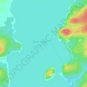
Name: Doe Lake topographic map, elevation, terrain.
Average elevation: 303 m
Minimum elevation: 287 m
Maximum elevation: 364 m
Thank you for supporting this site ❤️
Make a donation
Make a donation
Other topographic maps
Click on a map to view its topography, its elevation and its terrain.
Buck Lake
Canada > Ontario > Parry Sound District > McMurrich/Monteith Township
Average elevation: 325 m