
Thank you for supporting this site ❤️
Make a donation
Make a donation
Predeluț topographic map
Click on the map to display elevation.
Thank you for supporting this site ❤️
Make a donation
Make a donation
About this map
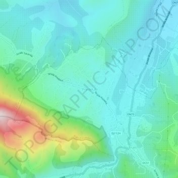
Name: Predeluț topographic map, elevation, terrain.
Location: Predeluț, Bran, Brașov, 507026, Romania (45.50944 25.33756 45.54944 25.37756)
Average elevation: 815 m
Minimum elevation: 690 m
Maximum elevation: 1,303 m
Thank you for supporting this site ❤️
Make a donation
Make a donation
Other topographic maps
Click on a map to view its topography, its elevation and its terrain.
Thank you for supporting this site ❤️
Make a donation
Make a donation