
Monroe topographic map
Interactive map
Click on the map to display elevation.
About this map
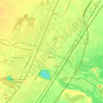
Name: Monroe topographic map, elevation, terrain.
Location: Monroe, Monroe County, Michigan, USA (41.88681 -83.44217 41.95087 -83.33351)
Average elevation: 182 m
Minimum elevation: 157 m
Maximum elevation: 200 m