Geolocate

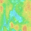
New Tusket topographic map

Click on the map to display elevation.

About this map

Name: New Tusket topographic map, elevation, terrain.

Location: New Tusket, Clare Municipal District, Digby County, Nova Scotia, Canada (44.22793 -65.95664 44.29777 -65.81927)

Average elevation: 83 m

Minimum elevation: 59 m

Maximum elevation: 133 m

Other topographic maps

Click on a map to view its topography, its elevation and its terrain.
Lighthouse Road

Canada > Nova Scotia > Digby County > Bay View

Average elevation: 44 m

Snare Lake

Canada > Nova Scotia > Digby County > Hectanooga

Average elevation: 65 m

Digby Neck

Canada > Nova Scotia > Digby County > Lake Midway

Average elevation: 58 m

Tobacco Lake

Canada > Nova Scotia > Digby County > Morganville

Average elevation: 143 m